Healthc Inform Res.
2012 Jun;18(2):88-96. 10.4258/hir.2012.18.2.88.
Geographical Information Systems and Health: Current State and Future Directions
- Affiliations
-
- 1Health Informatics Institute and Department of Sociology, Algoma University, Sault Ste. Marie, ON, Canada. nicola.shaw@algomau.ca
- KMID: 2045572
- DOI: http://doi.org/10.4258/hir.2012.18.2.88
Abstract
- This paper provides an introduction to Geographical Information Systems (GIS) and how they can be used. It reviews the current state of GIS use in health care before identifying the barriers to more pervasive use of GIS in health. Finally, it makes recommendations for the direction of health GIS research over the next decade and concludes with a call to action to health informatics researchers to stop ignoring a tool and methodology that has such immense potential for improving the health of our communities.
Keyword
MeSH Terms
Figure
-
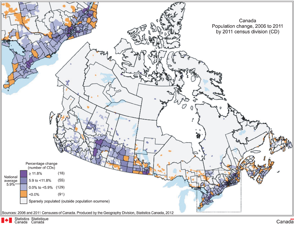
Figure 1 Mapping Change of Canada Population, 2006-2011.
Cited by 1 articles
-
Nursing Informatics: Decades of Contribution to Health Informatics
Anne Moen, Lina Merete Mæland Knudsen
Healthc Inform Res. 2013;19(2):86-92. doi: 10.4258/hir.2013.19.2.86.
Reference
-
1. Cooper MM. The Dartmouth Atlas of Health Care: what is it telling us? Health Syst Rev. 1996. 29:44–45. 472. Joyce K. "To me it's just another tool to help understand the evidence": public health decision-makers' perceptions of the value of geographical information systems (GIS). Health Place. 2009. 15:801–810.
Article3. Nykiforuk CI, Flaman LM. Geographic information systems (GIS) for health promotion and public health: a review. Health Promot Pract. 2011. 12:63–73.
Article4. Boulos MN. Towards evidence-based, GIS-driven national spatial health information infrastructure and surveillance services in the United Kingdom. Int J Health Geogr. 2004. 3:1.5. Snow J. On the mode of communication of cholera. 1849. London, UK: John Churchill.6. World Health Organization. The world health report 2003: shaping the future. 2003. Geneva, Switzerland: World Health Organization.7. Menezes JP. Going public [Internet]. 2004. cited at 2012 Jun 11. Scarborough, Canada: IT World Canada;Available from: http://www.itworldcanada.com/news/going-public/116928-pg3.8. DeMers MN. GIS [Internet]. c2012. cited at 2012 Jun 11. London, UK: Encyclopaedia Britannica;Available from: http://www.britannica.com/EBchecked/topic/1033394/GIS.9. Kaplan R. Murder by medical malice: the love-hate relationship between Dr Harold Shipman and his patients. S Afr Med J. 2000. 90:598–601.10. Baker R. Implications of Harold Shipman for general practice. Postgrad Med J. 2004. 80:303–306.
Article11. Baker R, Hurwitz B. Intentionally harmful violations and patient safety: the example of Harold Shipman. J R Soc Med. 2009. 102:223–227.
Article12. Shaw NT. Electronic patient records in primary care: study has serious flaw. BMJ. 2003. 327:622.
Article13. Clarke KC, McLafferty SL, Tempalski BJ. On epidemiology and geographic information systems: a review and discussion of future directions. Emerg Infect Dis. 1996. 2:85–92.
Article14. McLafferty SL. GIS and health care. Annu Rev Public Health. 2003. 24:25–42.
Article15. Graves BA. Integrative literature review: a review of literature related to geographical information systems, healthcare access, and health outcomes. Perspect Health Inf Manag. 2008. 5:11.16. Dugas AF, Hsieh YH, Levin SR, Pines JM, Mareiniss DP, Mohareb A, Gaydos CA, Perl TM, Rothman RE. Google Flu Trends: correlation with emergency department influenza rates and crowding metrics. Clin Infect Dis. 2012. 54:463–469.
Article17. Duncombe J, Clements A, Hu W, Weinstein P, Ritchie S, Espino FE. Geographical information systems for dengue surveillance. Am J Trop Med Hyg. 2012. 86:753–755.
Article18. Horst MA, Coco AS. Observing the spread of common illnesses through a community: using geographic information systems (GIS) for surveillance. J Am Board Fam Med. 2010. 23:32–41.
Article19. Khan OA, Davenhall W, Ali M, Castillo-Salgado C, Vazquez-Prokopec G, Kitron U, Soares Magalhaes RJ, Clements AC. Geographical information systems and tropical medicine. Ann Trop Med Parasitol. 2010. 104:303–318.
Article20. Simoonga C, Utzinger J, Brooker S, Vounatsou P, Appleton CC, Stensgaard AS, Olsen A, Kristensen TK. Remote sensing, geographical information system and spatial analysis for schistosomiasis epidemiology and ecology in Africa. Parasitology. 2009. 136:1683–1693.
Article21. Daniel M, Kolar J, Zeman P. GIS tools for tick and tick-borne disease occurrence. Parasitology. 2004. 129:Suppl. S329–S352.
Article22. Mungrue K, Mahabir R. The rabies epidemic in Trinidad of 1923 to 1937: an evaluation with a geographic information system. Wilderness Environ Med. 2011. 22:28–36.
Article23. Kelly GC, Hii J, Batarii W, Donald W, Hale E, Nausien J, Pontifex S, Vallely A, Tanner M, Clements A. Modern geographical reconnaissance of target populations in malaria elimination zones. Malar J. 2010. 9:289.
Article24. Sipe NG, Dale P. Challenges in using geographic information systems (GIS) to understand and control malaria in Indonesia. Malar J. 2003. 2:36.25. Singer BH, de Castro MC. Agricultural colonization and malaria on the Amazon frontier. Ann N Y Acad Sci. 2001. 954:184–222.
Article26. Ghebreyesus TA, Witten KH, Getachew A, O'Neill K, Bosman A, Teklehaimanot A. Community-based malaria control in Tigray, northern Ethiopia. Parassitologia. 1999. 41:367–371.27. Najera JA. Prevention and control of malaria epidemics. Parassitologia. 1999. 41:339–347.28. Kandwal R, Garg PK, Garg RD. Health GIS and HIV/AIDS studies: perspective and retrospective. J Biomed Inform. 2009. 42:748–755.
Article29. Vanmeulebrouk B, Rivett U, Ricketts A, Loudon M. Open source GIS for HIV/AIDS management. Int J Health Geogr. 2008. 7:53.
Article30. Aneja S, Gross CP, Soulos PR, Yu JB. Geographical information systems: applications and limitations in oncology research. Oncology (Williston Park). 2011. 25:1221–1225.31. Bell BS, Hoskins RE, Pickle LW, Wartenberg D. Current practices in spatial analysis of cancer data: mapping health statistics to inform policymakers and the public. Int J Health Geogr. 2006. 5:49.32. Flahault A, Blanchon T, Dorléans Y, Toubiana L, Vibert JF, Valleron AJ. Virtual surveillance of communicable diseases: a 20-year experience in France. Stat Methods Med Res. 2006. 15:413–421.
Article33. Rogers DJ, Randolph SE. Studying the global distribution of infectious diseases using GIS and RS. Nat Rev Microbiol. 2003. 1:231–237.
Article34. Nyamogoba HD, Obala AA, Kakai R. Combating cholera epidemics by targeting reservoirs of infection and transmission routes: a review. East Afr Med J. 2002. 79:150–155.
Article35. Cattand P, Jannin J, Lucas P. Sleeping sickness surveillance: an essential step towards elimination. Trop Med Int Health. 2001. 6:348–361.
Article36. Tatem AJ, Adamo S, Bharti N, Burgert CR, Castro M, Dorelien A, Fink G, Linard C, Mendelsohn J, Montana L, Montgomery MR, Nelson A, Noor AM, Pindolia D, Yetman G, Balk D. Mapping populations at risk: improving spatial demographic data for infectious disease modeling and metric derivation. Popul Health Metr. 2012. 10:8.
Article37. Taylor J, Lai KM, Davies M, Clifton D, Ridley I, Biddulph P. Flood management: prediction of microbial contamination in large-scale floods in urban environments. Environ Int. 2011. 37:1019–1029.
Article38. Levy JI, Clougherty JE, Baxter LK, Houseman EA, Paciorek CJ. HEI Health Review Committee. Evaluating heterogeneity in indoor and outdoor air pollution using land-use regression and constrained factor analysis. Res Rep Health Eff Inst. 2010. (152):5–80.39. Zou B, Wilson JG, Zhan FB, Zeng Y. Air pollution exposure assessment methods utilized in epidemiological studies. J Environ Monit. 2009. 11:475–490.
Article40. Zhou Y, Levy JI. Factors influencing the spatial extent of mobile source air pollution impacts: a meta-analysis. BMC Public Health. 2007. 7:89.
Article41. Mindell J, Barrowcliffe R. Linking environmental effects to health impacts: a computer modelling approach for air pollution. J Epidemiol Community Health. 2005. 59:1092–1098.
Article42. Scoggins A. Does air pollution pose a public health problem for New Zealand? Aust N Z J Public Health. 2004. 28:16–19.
Article43. Bytnerowicz A, Badea O, Barbu I, Fleischer P, Fraczek W, Gancz V, Godzik B, Grodzinska K, Grodzki W, Karnosky D, Koren M, Krywult M, Krzan Z, Longauer R, Mankovska B, Manning WJ, McManus M, Musselman RC, Novotny J, Popescu F, Postelnicu D, Prus-Głowacki W, Skawinski P, Skiba S, Szaro R, Tamas S, Vasile C. New international long-term ecological research on air pollution effects on the Carpathian Mountain forests, Central Europe. Environ Int. 2003. 29:367–376.
Article44. Dent AL, Fowler DA, Kaplan BM, Zarus GM, Henriques WD. Using GIS to study the health impact of air emissions. Drug Chem Toxicol. 2000. 23:161–178.
Article45. Jex AR, Lim YA, Bethony JM, Hotez PJ, Young ND, Gasser RB. Soil-transmitted helminths of humans in Southeast Asia - towards integrated control. Adv Parasitol. 2011. 74:231–265.46. Khan NI, Owens G, Bruce D, Naidu R. Human arsenic exposure and risk assessment at the landscape level: a review. Environ Geochem Health. 2009. 31:Suppl 1. 143–166.
Article47. Luber G, McGeehin M. Climate change and extreme heat events. Am J Prev Med. 2008. 35:429–435.
Article48. Maynard NG, Conway GA. A view from above: use of satellite imagery to enhance our understanding of potential impacts of climate change on human health in the Arctic. Alaska Med. 2007. 49:38–43.49. Twumasi YA, Merem EC. Using remote sensing and GIS in the analysis of ecosystem decline along the River Niger Basin: the case of Mali and Niger. Int J Environ Res Public Health. 2007. 4:173–184.
Article50. Fenske RA. State-of-the-art measurement of agricultural pesticide exposures. Scand J Work Environ Health. 2005. 31:Suppl 1. 67–73.51. Kamińska IA, Ołdak A, Turski WA. Geographical information system (GIS) as a tool for monitoring and analysing pesticide pollution and its impact on public health. Ann Agric Environ Med. 2004. 11:181–184.52. Nuckols JR, Ward MH, Jarup L. Using geographic information systems for exposure assessment in environmental epidemiology studies. Environ Health Perspect. 2004. 112:1007–1015.
Article53. Jarup L. Health and environment information systems for exposure and disease mapping, and risk assessment. Environ Health Perspect. 2004. 112:995–997.
Article54. Davenhall B. Can geographic information make you healthy? c2012. cited at 2012 Jun 11. Redlands, CA: ESRI;Available from: http://www.esri.com/industries/health/geomedicine/index.html.55. ESRI [Internet]. c2012. cited at 2012 Jun 11. Redlands, CA: ESRI;Available from: http://www.esri.com/.56. Macgregor S, Thickett A. Partnerships and communities in English drug policy: the challenge of deprivation. Int J Drug Policy. 2011. 22:478–490.
Article57. Clark RA, Driscoll A. Access and quality of heart failure management programs in Australia. Aust Crit Care. 2009. 22:111–116.
Article58. Parker EB, Campbell JL. Measuring access to primary medical care: some examples of the use of geographical information systems. Health Place. 1998. 4:183–193.
Article59. Lerner EB, Billittier AJ 4th, Sikora J, Moscati RM. Use of a geographic information system to determine appropriate means of trauma patient transport. Acad Emerg Med. 1999. 6:1127–1133.
Article60. Baumgardner DJ, Halsmer SE, Steber DL, Shah DS, Mundt MP. Does proximity to clinic affect immunization rates and blood pressure. Int J Psychiatry Med. 2006. 36:199–209.
Article61. Courtney KL. Visualizing nursing workforce distribution: policy evaluation using geographic information systems. Int J Med Inform. 2005. 74:980–988.
Article62. Bauer IL, Puotinen M. Geographic information systems and travel health. J Travel Med. 2002. 9:308–314.
Article63. Culham LE, Ryan B, Jackson AJ, Hill AR, Jones B, Miles C, Young JA, Bunce C, Bird AC. Low vision services for vision rehabilitation in the United Kingdom. Br J Ophthalmol. 2002. 86:743–747.
Article64. Juang D, Feliz A, Miller KA, Gaines BA. Sledding injuries: a rationale for helmet usage. J Trauma. 2010. 69:S206–S208.
Article65. Schuurman N, Hameed SM, Fiedler R, Bell N, Simons RK. The spatial epidemiology of trauma: the potential of geographic information science to organize data and reveal patterns of injury and services. Can J Surg. 2008. 51:389–395.66. Edelman LS. Using geographic information systems in injury research. J Nurs Scholarsh. 2007. 39:306–311.
Article67. Peleg K, Pliskin JS. A geographic information system simulation model of EMS: reducing ambulance response time. Am J Emerg Med. 2004. 22:164–170.
Article68. Dulin MF, Ludden TM, Tapp H, Smith HA, de Hernandez BU, Blackwell J, Furuseth OJ. Geographic information systems (GIS) demonstrating primary care needs for a transitioning hispanic community. J Am Board Fam Med. 2010. 23:109–120.
Article69. Dulin MF, Ludden TM, Tapp H, Blackwell J, de Hernandez BU, Smith HA, Furuseth OJ. Using Geographic information systems (GIS) to understand a community's primary care needs. J Am Board Fam Med. 2010. 23:13–21.
Article70. Quon Huber MS, Van Egeren LA, Pierce SJ, Foster-Fishman PG. GIS applications for community-based research and action: mapping change in a community-building initiative. J Prev Interv Community. 2009. 37:5–20.
Article71. Ryan K, Norris P, Becket G. Capturing data on medicines usage: the potential of community pharmacy databases. N Z Med J. 2005. 118:U1677.72. Boulos MN. Geographic information systems and the spiritual dimension of health: a short position paper. Int J Health Geogr. 2003. 2:6.73. Cutchin MP, Eschbach K, Mair CA, Ju H, Goodwin JS. The socio-spatial neighborhood estimation method: an approach to operationalizing the neighborhood concept. Health Place. 2011. 17:1113–1121.
Article74. Gray JA, Zimmerman JL, Rimmer JH. Built environment instruments for walkability, bikeability, and recreation: disability and universal design relevant? Disabil Health J. 2012. 5:87–101.
Article75. Butler EN, Ambs AM, Reedy J, Bowles HR. Identifying GIS measures of the physical activity built environment through a review of the literature. J Phys Act Health. 2011. 8:Suppl 1. S91–S97.
Article76. Brownson RC, Hoehner CM, Day K, Forsyth A, Sallis JF. Measuring the built environment for physical activity: state of the science. Am J Prev Med. 2009. 36:S99–S123.77. Wong BY, Faulkner G, Buliung R. GIS measured environmental correlates of active school transport: a systematic review of 14 studies. Int J Behav Nutr Phys Act. 2011. 8:39.
Article78. Charreire H, Casey R, Salze P, Simon C, Chaix B, Banos A, Badariotti D, Weber C, Oppert JM. Measuring the food environment using geographical information systems: a methodological review. Public Health Nutr. 2010. 13:1773–1785.
Article79. Duncan MJ, Badland HM, Mummery WK. Applying GPS to enhance understanding of transport-related physical activity. J Sci Med Sport. 2009. 12:549–556.
Article80. Hammel J, Jones R, Smith J, Sanford J, Bodine C, Johnson M. Environmental barriers and supports to the health, function, and participation of people with developmental and intellectual disabilities: report from the State of the Science in Aging with Developmental Disabilities Conference. Disabil Health J. 2008. 1:143–149.
Article81. Wieczorek WF, Hanson CE. New modeling methods: geographic information systems and spatial analysis. Alcohol Health Res World. 1997. 21:331–339.82. Kamel Boulos MN, Resch B, Crowley DN, Breslin JG, Sohn G, Burtner R, Pike WA, Jezierski E, Chuang KY. Crowdsourcing, citizen sensing and sensor web technologies for public and environmental health surveillance and crisis management: trends, OGC standards and application examples. Int J Health Geogr. 2011. 10:67.
Article83. Mathew D. Information technology and public health management of disasters - a model for South Asian countries. Prehosp Disaster Med. 2005. 20:54–60.
Article84. Kaiser R, Spiegel PB, Henderson AK, Gerber ML. The application of geographic information systems and global positioning systems in humanitarian emergencies: lessons learned, programme implications and future research. Disasters. 2003. 27:127–140.
Article85. Higgs G, Smith DP, Gould MI. Findings from a survey on GIS use in the UK National Health Service: organisational challenges and opportunities. Health Policy. 2005. 72:105–117.
Article86. Higgs G, Gould M. Is there a role for GIS in the 'new NHS'? Health Place. 2001. 7:247–259.
Article87. Croner CM. Public health, GIS, and the internet. Annu Rev Public Health. 2003. 24:57–82.
Article88. Rushton G. Public health, GIS, and spatial analytic tools. Annu Rev Public Health. 2003. 24:43–56.
Article89. Cromley EK. GIS and disease. Annu Rev Public Health. 2003. 24:7–24.
Article
- Full Text Links
-
- Actions
-
Cited
- CITED
-
- Close
- Share
-
- Similar articles
-
- Geographical Information Systems and Health: Current State and Future Directions
- Wearable Sensors in Healthcare and Sensor-Enhanced Health Information Systems: All Our Tomorrows?
- The Business Analysis on the Chronic Disease Management in PublicHealth Centers for the Electronic Health Records System
- Future Directions for Next-Generation Hospital Information System
- Leveraging Devices, Data and Discovery for Smarter Healthcare in Japan
